|
| Home |
Maps/Directions |Scenic Byways |
Oregon Wineries
| Southeast Oregon
|
| Umpqua
Valley/Oregon Wine Tour Map |
Rouge-Umpqua
Scenic Byway
 The
Rogue-Umpqua Scenic Byway is a scenic loop
that starts in Roseburg and ends at Gold
Hill, just north of Medford and I-5.
There is much to see along this beautiful
byway including numerous waterfalls, Diamond
Lake, Crater Lake, the North Umpqua and
Rogue Rivers and many geological wonders
created by the formation of the Cascade
Mountains. The
Rogue-Umpqua Scenic Byway is a scenic loop
that starts in Roseburg and ends at Gold
Hill, just north of Medford and I-5.
There is much to see along this beautiful
byway including numerous waterfalls, Diamond
Lake, Crater Lake, the North Umpqua and
Rogue Rivers and many geological wonders
created by the formation of the Cascade
Mountains.
 This
loop takes you from an elevation of 400' to
over 5000' so during the fall, winter and
spring months you will want to check the
Oregon road conditions. Take a day
drive and do the entire "loop" seeing just
the highlights or take several days and
enjoy the spectacular beauty of all there is
to see. On this page we are just
presenting the loop through to the upper
Rogue Valley, which is the area that is
considered the most scenic. The total
distance of this complete loop is just under
200 miles and is an easy day trip that
allows with some stops along the way.
The loop is divided into three segments, the
"North Umpqua", "The High Cascades",
and the "Upper Rogue". This
loop takes you from an elevation of 400' to
over 5000' so during the fall, winter and
spring months you will want to check the
Oregon road conditions. Take a day
drive and do the entire "loop" seeing just
the highlights or take several days and
enjoy the spectacular beauty of all there is
to see. On this page we are just
presenting the loop through to the upper
Rogue Valley, which is the area that is
considered the most scenic. The total
distance of this complete loop is just under
200 miles and is an easy day trip that
allows with some stops along the way.
The loop is divided into three segments, the
"North Umpqua", "The High Cascades",
and the "Upper Rogue".
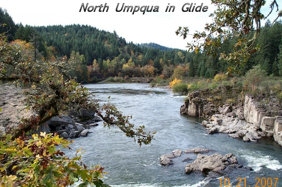
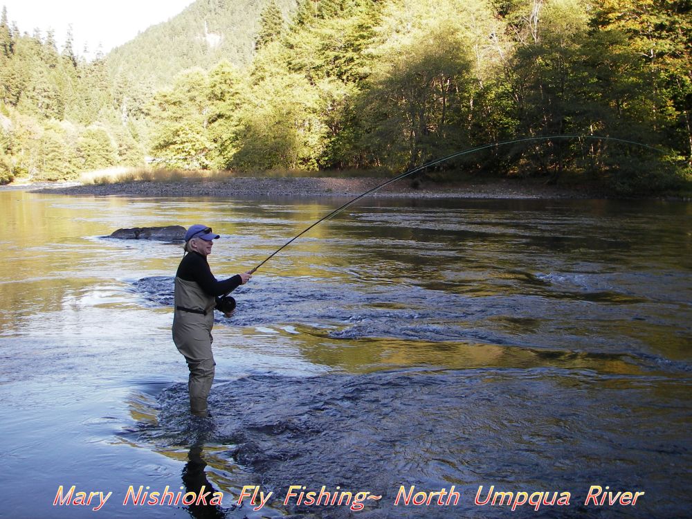
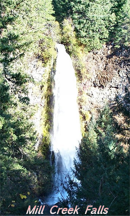
 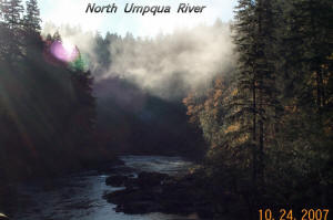 You
will be traveling high into the Cascade
Mountains which is also known as the
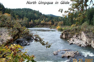
"Highway of Waterfalls". The first
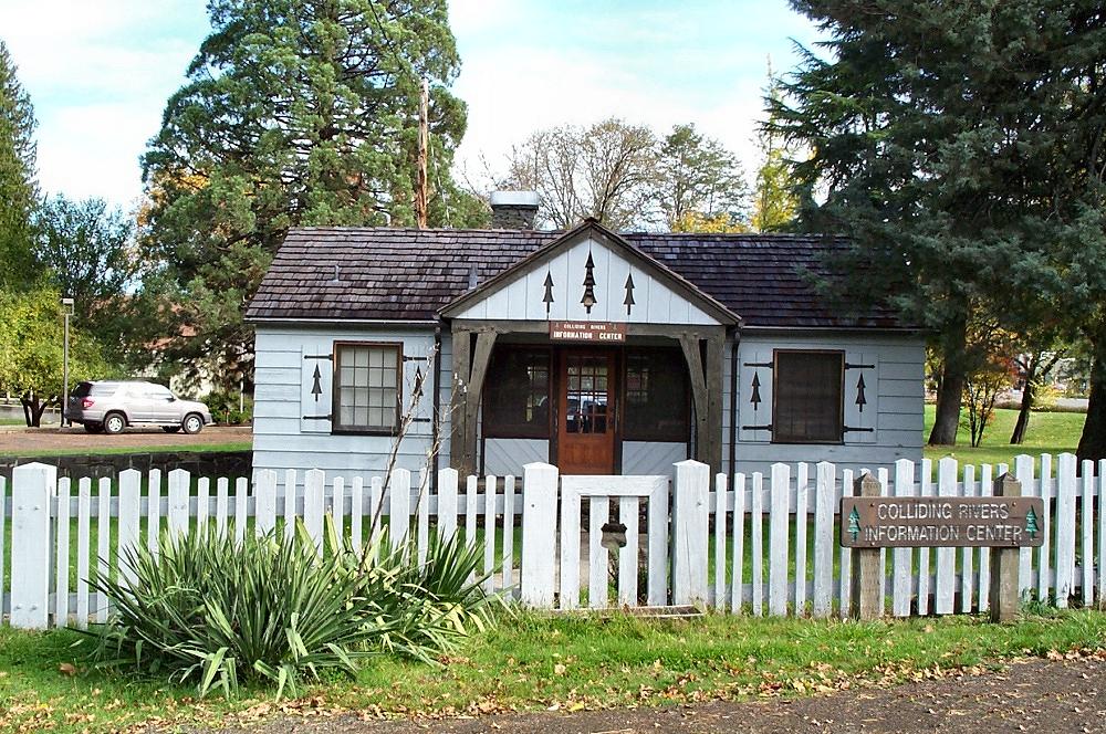
point of interest is in Glide where the
North Umpqua River crashes into the Little
River at the "Colliding Rivers", one of the
few places in the world where two rivers
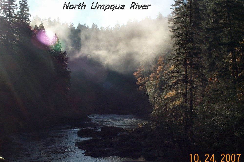
meet head-on. You continue on and pass
more than a dozen waterfalls along with
points of interest such as Rock Creek Fish
Hatchery, Illahee Flats, Motts Bridge and
the Umpqua Rocks Geologic Area before you
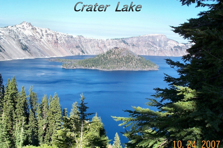
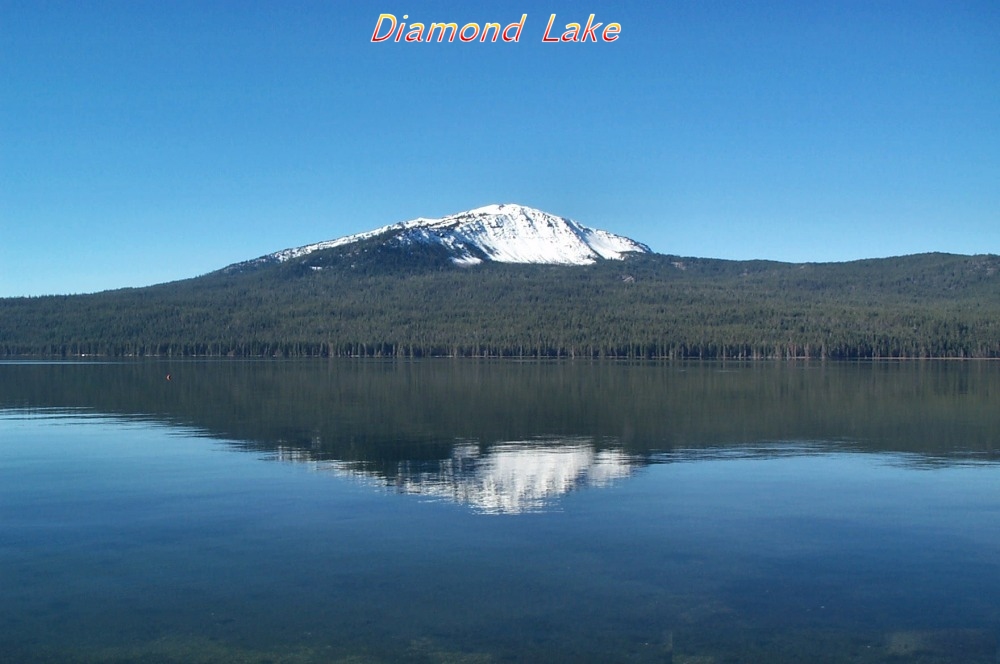
reach
Diamond Lake, a year-round playground
for biking, fishing and winter sports such
as snowshoeing, skiing and snowmobiling.
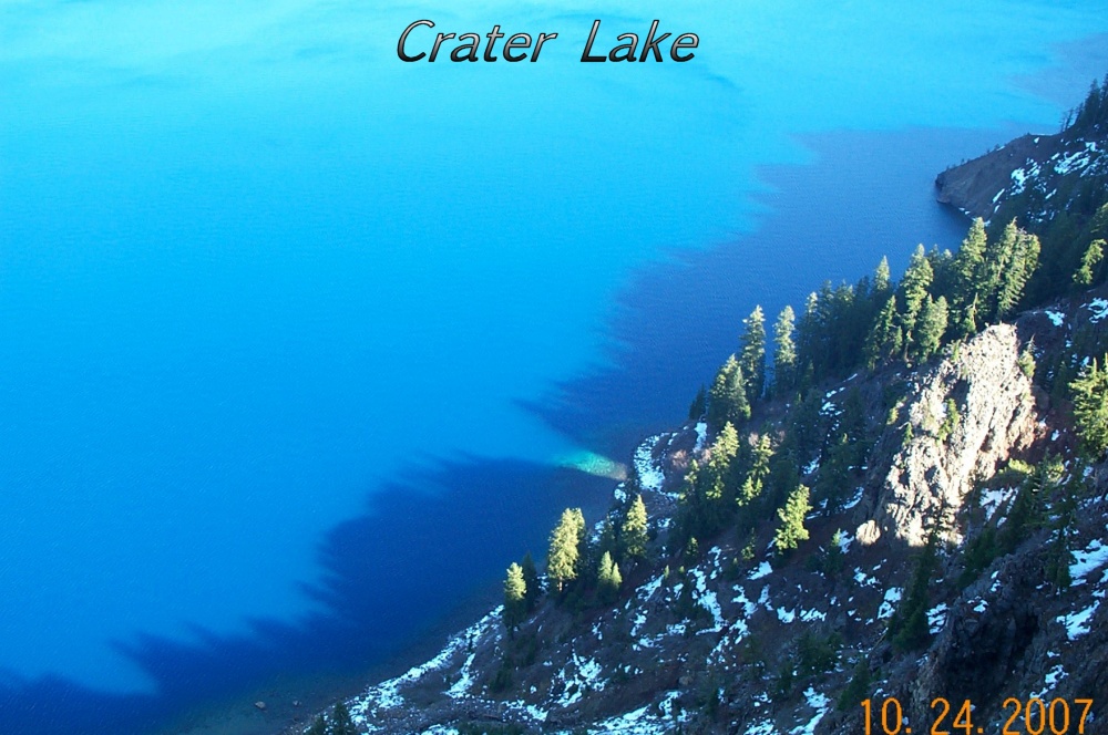
Then onwards to the north entrance of Crater
Lake which is open June through
September/October. In the winter you
gain access to the park by going to the
south entrance on Highway 62. This is
a must stop for any visitor, the beauty is
incomparable and the clarity and depth of
Crater Lake really has to be seen to be
appreciated. You
will be traveling high into the Cascade
Mountains which is also known as the
"Highway of Waterfalls". The first
point of interest is in Glide where the
North Umpqua River crashes into the Little
River at the "Colliding Rivers", one of the
few places in the world where two rivers
meet head-on. You continue on and pass
more than a dozen waterfalls along with
points of interest such as Rock Creek Fish
Hatchery, Illahee Flats, Motts Bridge and
the Umpqua Rocks Geologic Area before you
reach
Diamond Lake, a year-round playground
for biking, fishing and winter sports such
as snowshoeing, skiing and snowmobiling.
Then onwards to the north entrance of Crater
Lake which is open June through
September/October. In the winter you
gain access to the park by going to the
south entrance on Highway 62. This is
a must stop for any visitor, the beauty is
incomparable and the clarity and depth of
Crater Lake really has to be seen to be
appreciated.
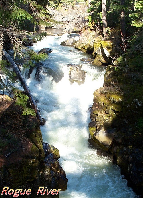
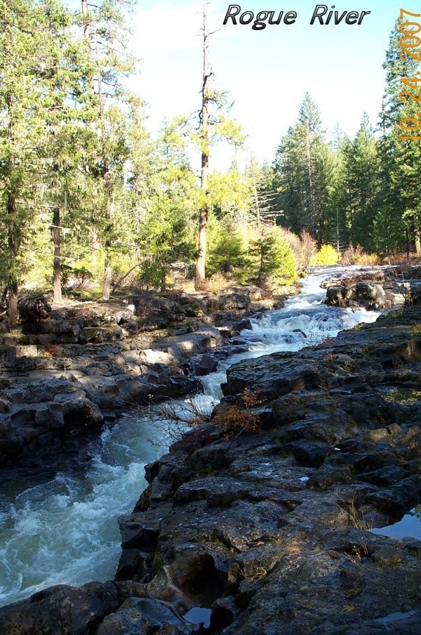
 After
visiting Crater Lake you continue your
journey on towards Gold Hill passing the
Rogue River Gorge
and Natural Bridge where the river has
carved its way through the rock beds of
ancient lava flows. There are two
geologic interpretive waysides less than one
mile apart to enjoy these two unique
wonders. Then onward to the the Lost
Creek Reservoir which calms the Rogue until
it leaves where the river once again becomes
turbulent, offering challenging rafting
adventures and world-class fishing that is
also found on the North Umpqua. After
visiting Crater Lake you continue your
journey on towards Gold Hill passing the
Rogue River Gorge
and Natural Bridge where the river has
carved its way through the rock beds of
ancient lava flows. There are two
geologic interpretive waysides less than one
mile apart to enjoy these two unique
wonders. Then onward to the the Lost
Creek Reservoir which calms the Rogue until
it leaves where the river once again becomes
turbulent, offering challenging rafting
adventures and world-class fishing that is
also found on the North Umpqua.
This
is a truly unique drive with many points of
interests, pull-outs and waysides.
Most of the small towns/settlements that you
pass through offer food and gas. The
hillsides are covered with mixes of conifers
such as Douglas Fir, Sugar Pine, Cedar and
Hemlock along with deicidous trees such as
Oaks, Madrones and many others. We
hope you enjoy your visit!
For
more information on this drive and/or a
brochure named "Rogue-Umpqua Scenic
Byway"
please contact one of the following:
Umpqua National Forest, the
Roseburg District Bureau of Land
Management
or the
Roseburg Visitors and Convention Bureau.
Roseburg District, Bureau of Land
Management
777 NW Garden Valley
Blvd.
Roseburg, OR 97470
(541)
440-4930
Umpqua National Forest
2900 NW Stewart
Parkway
Roseburg, OR 97470
North Umpqua Ranger District
(541) 496-3532
Diamond Lake Ranger
District
(541) 498-2531
Roseburg Visitors and Convention Bureau
410 SE Spruce Street
Roseburg, OR
97470
(541) 672-9731
|